The City of Hampton and the U.S. Army Corps of Engineers will work together to investigate flooding along coastal regions and rivers on the Virginia Peninsula that is exacerbated by sea level rise.
The city and the Norfolk district of the U.S. Army Corps of Engineers received approval in December from the Corps’ national headquarters to conduct the Virginia Peninsula Coastal Storm Risk Management Feasibility Study.
The study includes low-lying areas that have experienced repetitive damage from coastal storms, rainfall and flooding.
The study is 100% federally funded for an initial $3 million and approved under the Long-Term Disaster Recovery Investment Plan component of the 2019 Additional Supplemental Appropriations Disaster Relief Act.
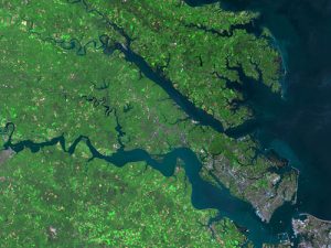
The study area is comprised of the cities of Hampton, Newport News, Poquoson and Williamsburg, as well and York and James River counties. It is bounded by the James River to the south, Chesapeake Bay to the east and the York River to the north.
The study will examine the federal interest and the feasibility of implementing measures that may include building elevation or flood-proofing, nature-based solutions such as wetland restoration, and structural measures such as tide gates and flood walls to help manage the risk of storm damage.
Based on the study findings, the city and surrounding communities will partner with the Army Corps of Engineers to develop a plan to design measures that will lead to construction that will tangibly manage coastal storm risk and improve economic resiliency of the Peninsula region.
A detailed description of the study is available online: